World Heritage Sites
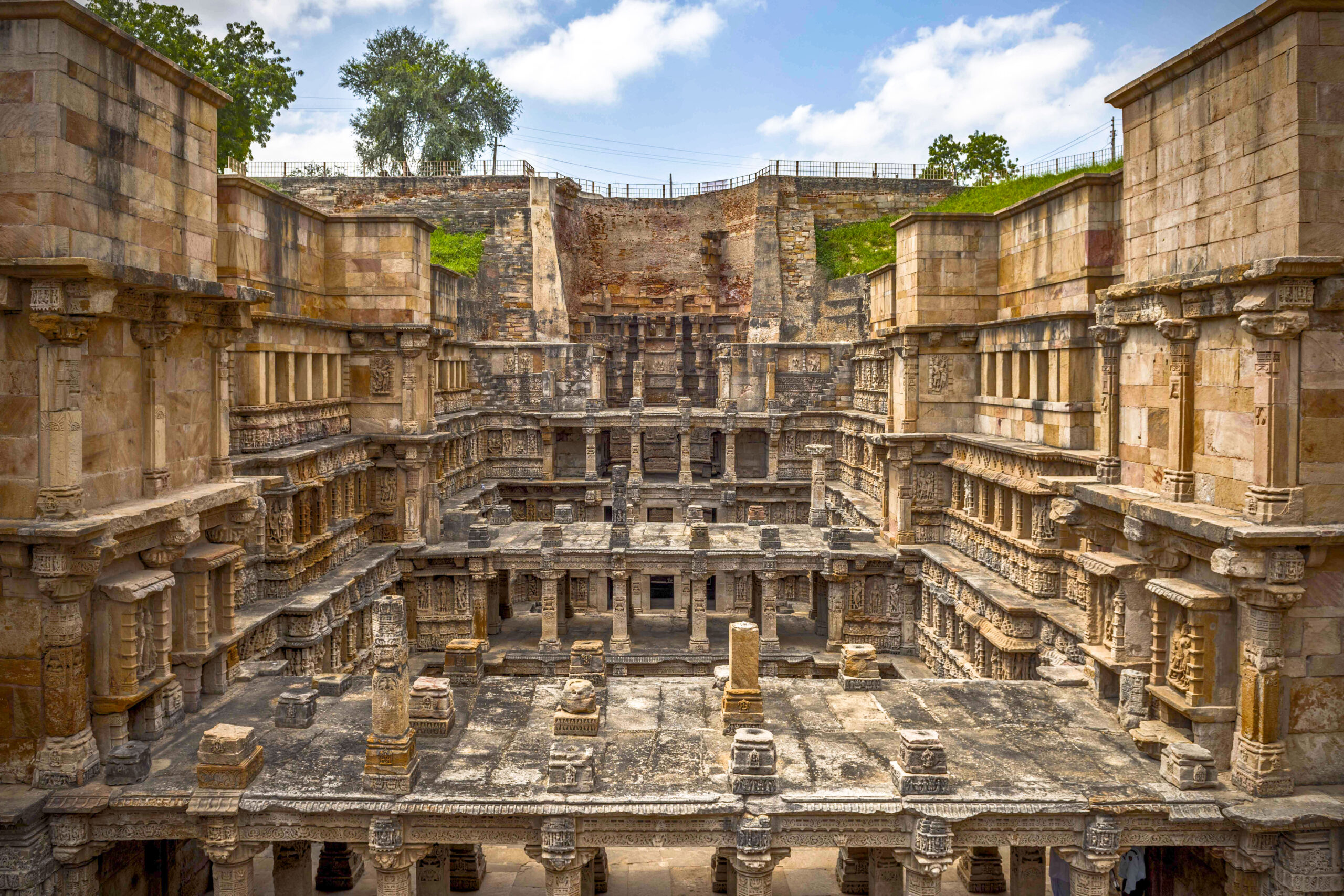
At a distance of 4 km from Patan Railway Station, Rani ki Vav is an intricately carved stepwell located in the fortified town of Patan. Situated on the banks of River Saraswati, it is one of the finest step-wells in India and among prime places to visit during your Patan trip.
Rani ki Vav was built by Rani Udayamati in memory of her husband Bhimdev I (1022 – 1063 AD) of the Solanki dynasty. The construction started around 1050 AD and was probably completed by Udayamati and Karandev I after the death of her husband. One can find the reference of Udayamati building the monument in the ‘Prabandha Chintamani’ composed by Merunga Suri in 1304 AD. The vav was later flooded by the nearby Saraswati River and silted over until the late 1980s, when it was excavated by the Archeological Survey of India, with the carvings found in pristine condition. Today, Rani Ki Vav is amongst the best step-wells in India, and one of the most famous legacies of the ancient capital city of Gujarat. It was added to the list of UNESCO’s World Heritage Sites in 2014 and also bagged the title of ‘Cleanest Iconic Place’ in India at the Indian Sanitation Conference 2016 in New Delhi.
Rani ki Vav was built in the complex Maru-Gurjara architectural style, and is one of the must-visit Patan places to visit. Designed as an inverted temple highlighting the sanctity of water, it is divided into seven levels of stairs with more than 500 principle sculptures and over a thousand minor ones combine with religious, mythological, and secular images. This magnificent east-facing step well measures approximately 64 m long, 20 m wide & 27 m deep. Every surface of the well and levels are adorned with fine sculptures of Hindu deities including those of Ganesh on the lower levels, preceded by those of Vishnu, Laxmi-Narayan, Uma-Mahesh, etc. The most imposing imagery is Lord Vishnu reclining on the thousand-hooded serpent Shesha at the water level of the Rani ki Vav.
Rani Ki Vav is quite possibly the only Vav that has such intricate patterns and religious ornamentations in a large amount. The staircases are straight as well as lateral, along with broad corridors that are surrounded by elaborately carved walls. Also, there is a small gate below the last step of the stepwell, with a 30-kilometer tunnel which leads to the town of Siddhpur near Patan. Earlier, it was used as an escape gateway for the king, who built the stepwell in the times of defeat, but currently, it was blocked by stones and mud.
During the month of December or January, a Rani ki Vav festival is held where one can enjoy the cultural programs along with exquisite local cuisine and street shopping.
Timings: 8 AM – 6 PM
Entry Fee: Rs. 40 for Indians & Rs. 600 for Foreigners
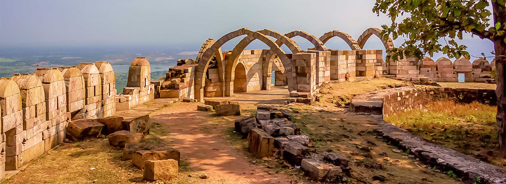
About the Place: A UNESCO Heritage site, Champaner and Pavagadh are often clubbed together as one of the most engaging historical attractions of Gujarat. Pavagadh stands on top of the hill that looks over the sprawl of monuments at the base in Champaner. The duo makes a rich heritage site dotted with forts, mosques, monuments, tombs, arches, temples, step-wells and fortresses from 8th to 14th century. Today, throngs of pilgrims ascend Pavagadh to worship at the important Kalikamata Temple, dedicated to the goddess Kali, who sits atop the summit. Champaner is the only unchanged Islamic-Mughal city over the centuries, offering an authentic flavour of architecture of the era. Juxtaposed to this is the Kalika Mata Temple on the Pavagadh Hill, where thousands congregate during Navratris.
At the heart of Champaner, is the Citadel, whose most impressive features are its 16th-century monumental mosques (no longer used for worship), with their beautiful blending of Islamic and Hindu architecture. The huge Jami Masjid, just outside the Citadel’s east gate, boasts of a wonderful carved entrance porch that leads into a lovely courtyard surrounded by a pillared corridor. The prayer hall has two tall central minarets, further superb stone carving, multiple domes, finely latticed windows and seven mihrabs (prayer niches) along the back wall.
Other beautiful mosques include the Saher ki Masjid, behind the ticket office inside the Citadel, which was probably the private royal mosque, and the Kevda Masjid, 300m north of the Citadel and about 600m west of the Jami Masjid. Here you can climb narrow stairs to the roof, and higher up the minarets, to spot other mosques even further out into the countryside – Nagina Masjid, 500m north, with no minarets but exquisite geometric carving, particularly on the tomb next to it, and Lila Gumbaj ki Masjid, 800m east, on a high platform and with a fluted central dome. The twin minarets resembling factory chimneys, about 1 km west, adorn the Brick Minar ki Masjid, a rare brick tomb.
Brief History: Pavagadh became the capital of the Chauhan Rajputs around 1300, but in 1484 was taken by the Gujarat Sultan Mahmud Begada, after a 20-month siege; the Rajputs committed jauhar (ritual mass suicide) in the face of defeat. Following his capture of Pavagadh, Sultan Mahmud Begada turned Champaner, at the base of the hill, into a splendid new capital. But its glory was brief: when it was captured by Mughal emperor Humayun in 1535, the Gujarati capital reverted to Ahmedabad, and Champaner fell into ruin.
Explore India´s first World Heritage City, Ahmedabad, Gujarat.
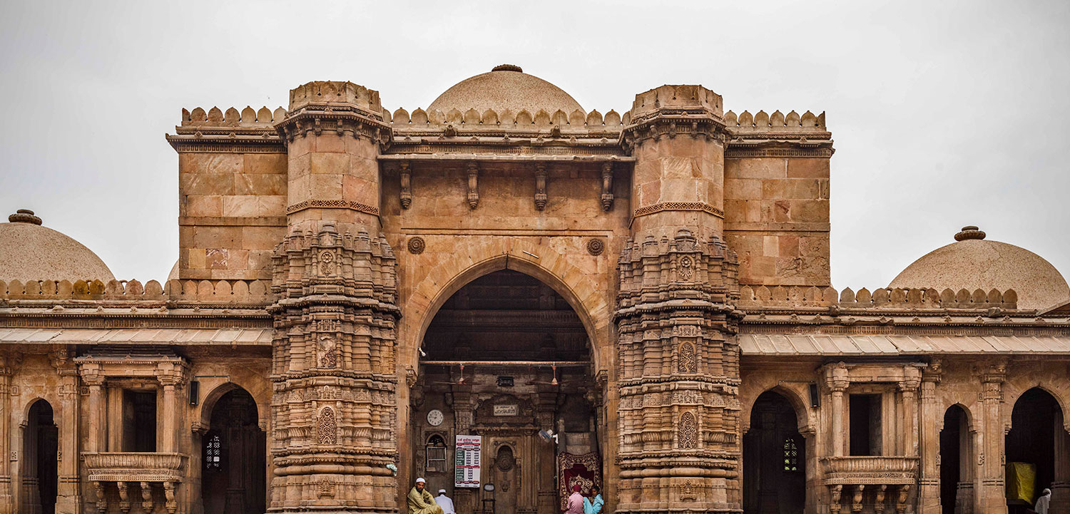
The city of Ahmedabad is endowed with a rich architectural heritage that is vital to the local identity and continuity of the place. Along with the foremost heritage Indo-Islamic monuments of the 15th to 17th centuries, there are potential heritage precincts in the form of the Pols, the traditional residential clusters of the medieval period, which makes Ahmedabad exceptional. Combining these all, the historic walled city of Ahmedabad has it all to be the first city in India to be inscribed in UNESCO’s World Heritage City list of 2017.
Historic City of Ahmedabad: Situated in the heart of Gujarat, Ahmedabad has a character like no other, defined by a spirit of enterprise. Although Ahmedabad is a bustling metropoliton with reputed institutes and a rapidly growing economy, it is also deeply rooted in tradition. The city is known for its association with Mahatma Gandhi and in addition to a complex maze of neighbourhood called pols, hosts some of the country’s finest medieval Islamic Architecture.
The city of Ahmedabad was formerly known as Ashawal of Asha Bhil; Karnavati of Karanadev, Ahamdabad of Sultan Ahmed Shah, Rajnagar, the capital of Jainism, a politico-cultural city of Mahatma Gandhi and Sardar Patel and Amdavad of ‘Amdavadis’. The Britishers spelled it as Ahmedabad and it became internationally known as Ahmedabad. But in vernacular language, it became popular as Amdavad and all the Gujaratis know it as Amdavadis. The citizens are known as Amdavadis across the world.
There are hundreds of temples, mosques and other pilgrim spots in the city. Among all, one spot glaringly draws our attention, which is none other than Sabarmati Ashram, offered to the nation by Gandhiji, his humble residence known as Hridaykunj.
UNESCO has included Dholavira of Kutch in the list of World Heritage Sites in 2021, giving Gujarat the opportunity to shine once again on the World Heritage Map. With the inclusion of Dholavira in the World Heritage Site, Gujarat has also got the pride of being a state with four World Heritage Sites.
About The Location: At the height of our civilization, our technological development, our social and material complexity, all signs point to progress, we often think. And yet, all is not as it seems and once in a while it occurs to us to look into the past to discover our future.
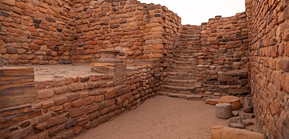
Dholavira is the larger of the two most remarkable excavations of the Indus Valley Civilization or Harappan culture, dating back to 4500 years ago. While the other site, Lothal, is more exhaustively educated and easier to reach, a visit to Lothal only complements, rather than replaces, a visit to Dholavira. What this site offers you, in the intense environment that comes with being surrounded by the Great Rann of Kutch, is a unique insight into the pioneering Harappan mind, with one of the world’s earliest and best planned water conservation systems and what might be the world’s first signboards, written in ancient Indus script.
The excavation also tells the story of the 7 stages of the civilization, from development to maturity to decay, the last of which hints at a strange piece of history, with more questions than answers. After the peak of the civilization Dholavira was temporarily abandoned, after which it seems that the settlers returned with a markedly de-urbanized culture. There are hints that they willingly chose to simplify their lives, rather than try to ride the collapse of their once glorified civilization. Here, on the ruins, you will have a chance to contemplate what progress and civilization mean and what, if anything, is truly permanent.
Background: Dholavira, known locally as Kotada (which means large fort), sprawls over 100 hectares of semi-arid land at the north-west corner of the island of Khadir, one of the islands in the Great Rann of Kutch that remain above the flood-plains in months when the rest of the desert is submerged by the monsoon. Dholavira has two seasonal nallahs, or streams: Mansar in the north, and Manhar in the south. The journey to Dholavira itself is beautiful, taking you through the saline desert plains of the Great Rann, where you can spot wildlife such as chinkara gazelle, nilgai (blue bull, the largest antelope in Asia), flamingos and other bird life.
The site was unearthed by the Archeological Survey of India (ASI) in 1967, but has been systematically excavated only since 1990. Artifacts include terracotta pottery, beads, gold and copper ornaments, seals, fish hooks, animal figurines, tools, urns, and some imported vessels that indicate trade links with lands as far away as Mesopotamia. Also found were 10 large stone inscriptions, carved in Indus Valley script, perhaps the world’s earliest signboard. These are among the most important discoveries about the Indus Valley Civilization, but remain tantalizingly undeciphered.
The remains show an imposing citadel in the center, with a middle and lower town, each fortified separately, built with pleasingly smoothed structures of sun-dried brick and stone masonry, and with remarkable town planning. Well laid out lanes lead outward systematically from the citadel, with a well-constructed underground drainage system for sanitation. There is a large stadium with a complex structure and seating arrangement.
Finally, Dholavira has one of the world’s earliest water conservation systems ever excavated. Satellite pictures show a reservoir underground, an expertly constructed rainwater harvesting system extending from the walls of the city, without which the settlement would not have thrived in the sparse rainfall of the desert.
Dholavira is one of the two largest Harappan sites in India, and 5th largest in the subcontinent. Like Lothal, it passed through all the stages of the Harappan culture from circa 2900 BC to 1500 BC, while most others saw only the early or late stages.
The excavation found a decline of the civilization in the 5th of 7th stages, after which were signs of a temporary desertion of the site. Settlers returned later in the late Harappan stage, with a change in their pottery, influenced by cultures found at sites in Sindh, South Rajasthan and other parts of Gujurat, but they did not bring the return of the civilization. Their houses, for example, were built in an entirely new form that was circular (bhungas), and the material signs were strikingly deurbanized and simplified. Perhaps the last stage of the powerful civilization had become aware of its future, and was preparing itself for a gradual end.


